America’s Endangered Coasts, from Texas to Maine

Ocean Front Paradise” Rental, TX 87, Bolivar Peninsula, Texas, 2014. Elevation Three Feet. N 29.53893 W 94.41699
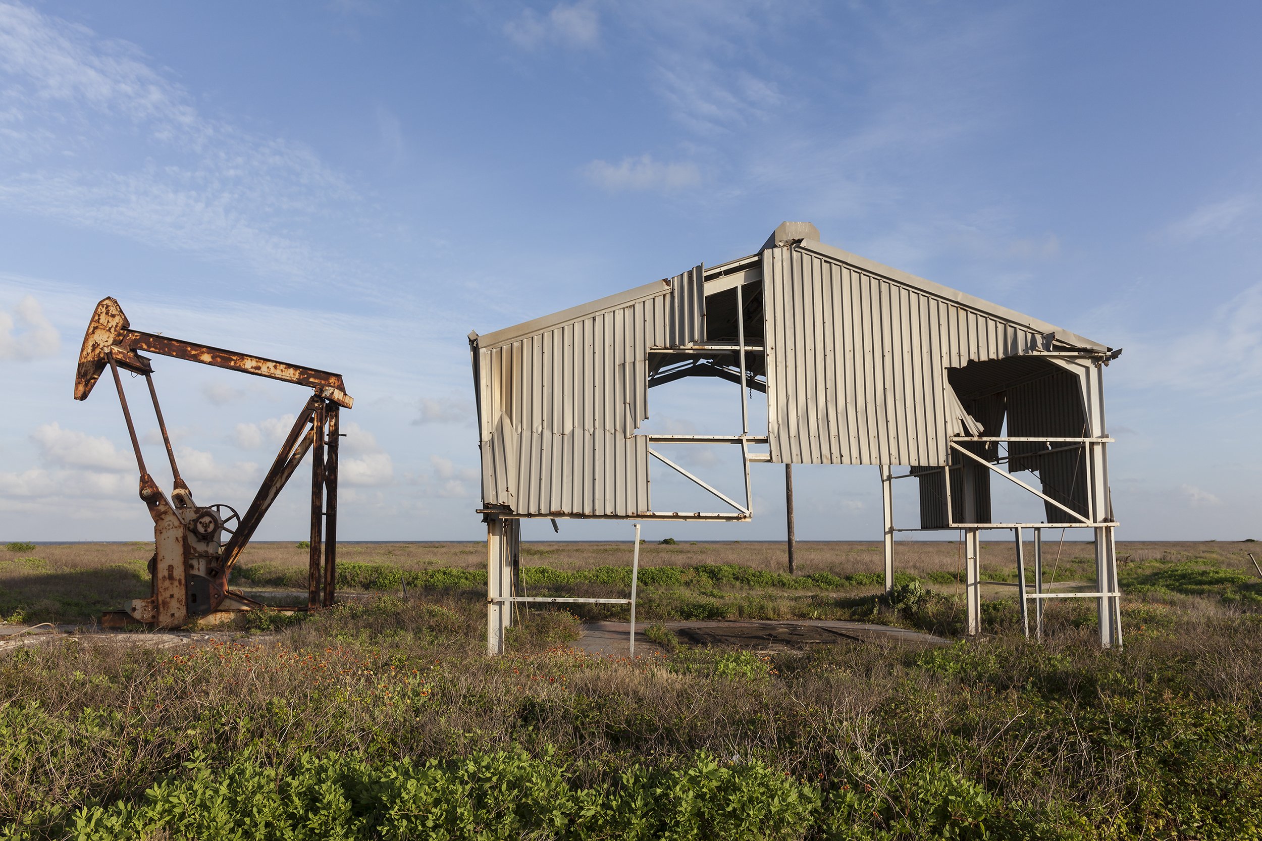
Derelict Oil Well and Building Damaged by Hurricane Ike, Bolivar Peninsula, Texas, 2014. Elevation Eight Feet. N 29.48473 W 94.56014

Abandoned Yacht, Jones Drive, Galveston, Texas, 2014. Elevation One Foot. N 29.26979 W 94.84696

Missing House and Improvised Basketball Court Removed, Blanchard Drive, Chalmette, New Orleans, Louisiana, June 2010 and June 2014. Elevation One Foot. N 29.94676 W 89.94012

Lot for Sale, House Destroyed by Hurricane Katrina, Bay St. Louis, Mississippi, 2014. Elevation Nine Feet. N 30.29171 W 89.32919
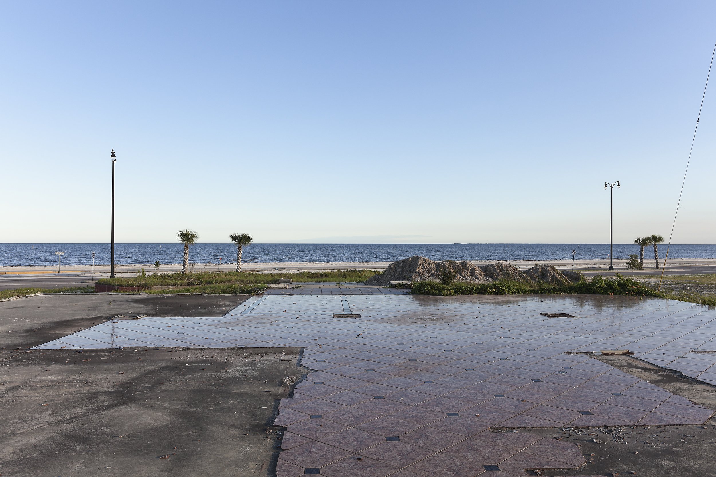
Floor of a Building Destroyed by Hurricane Katrina, Beach Boulevard, Gulfport, Mississippi, 2014. Elevation Eleven Feet. N 30.38144 W 89.03029

Sharkheads Souvenir Store, Completely Rebuilt after having been Destroyed by Hurricane Katrina, Biloxi, Mississippi, 2014. Elevation Eight Feet. N 30.39304 W 88.93968
Development on Sites Formerly Destroyed by Hurricane Ivan, Gulf Shores, Alabama, 2014. Elevation Twelve Feet. N 30.24326 W 87.71641.

Parking Area 21, Gulf Islands National Seashore, Subject to Frequent Flooding, Santa Rosa Island, Pensacola, Florida, 2014. Elevation Three Feet. N 30.32225 W 87.20926

Entrance to Coral Caye Development, Future Site of Ninety-five Homes, Cape Haze, Florida, 2014. Elevation Three Feet. N 26.86616 W 82.30568

Construction Site for a New Mansion, South Ocean Boulevard (FL A1A), Palm Beach, Florida, 2014. Elevation Eight Feet. N 26.65092 W 80.03703
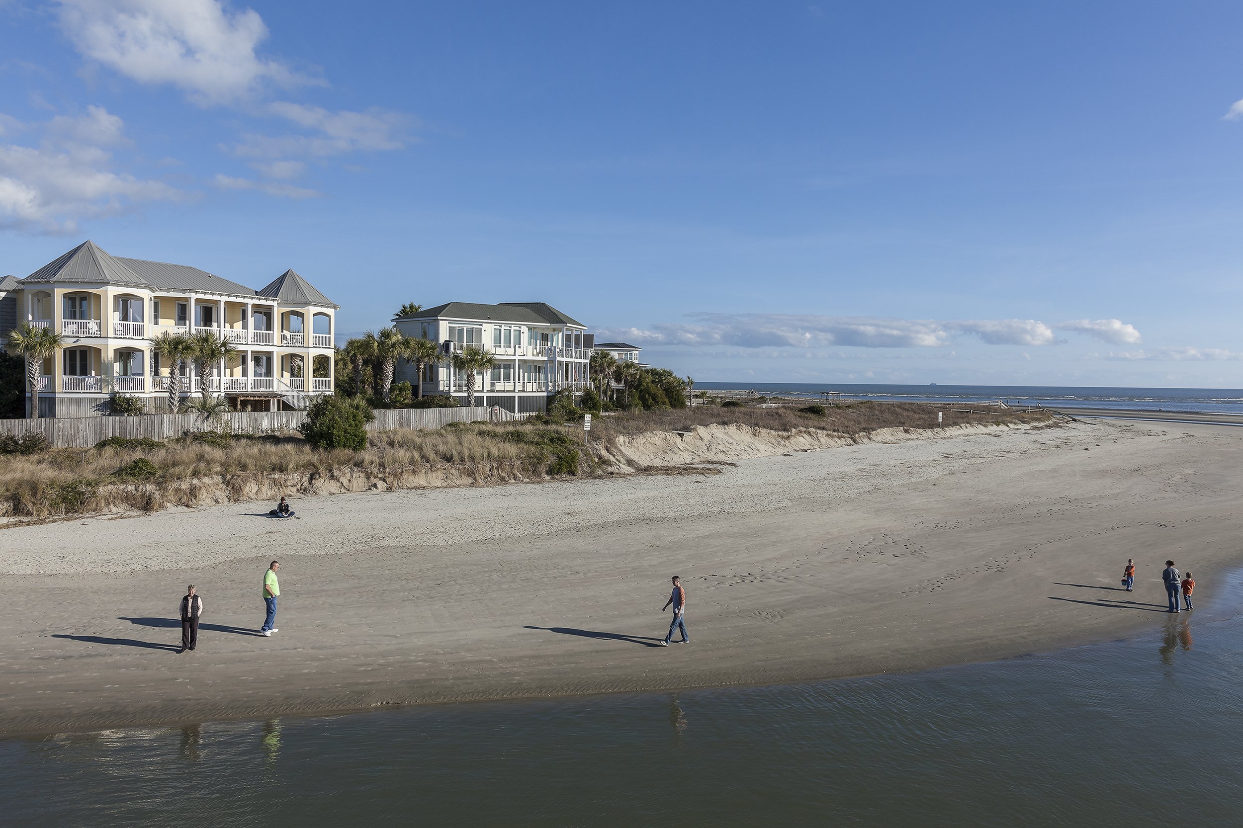
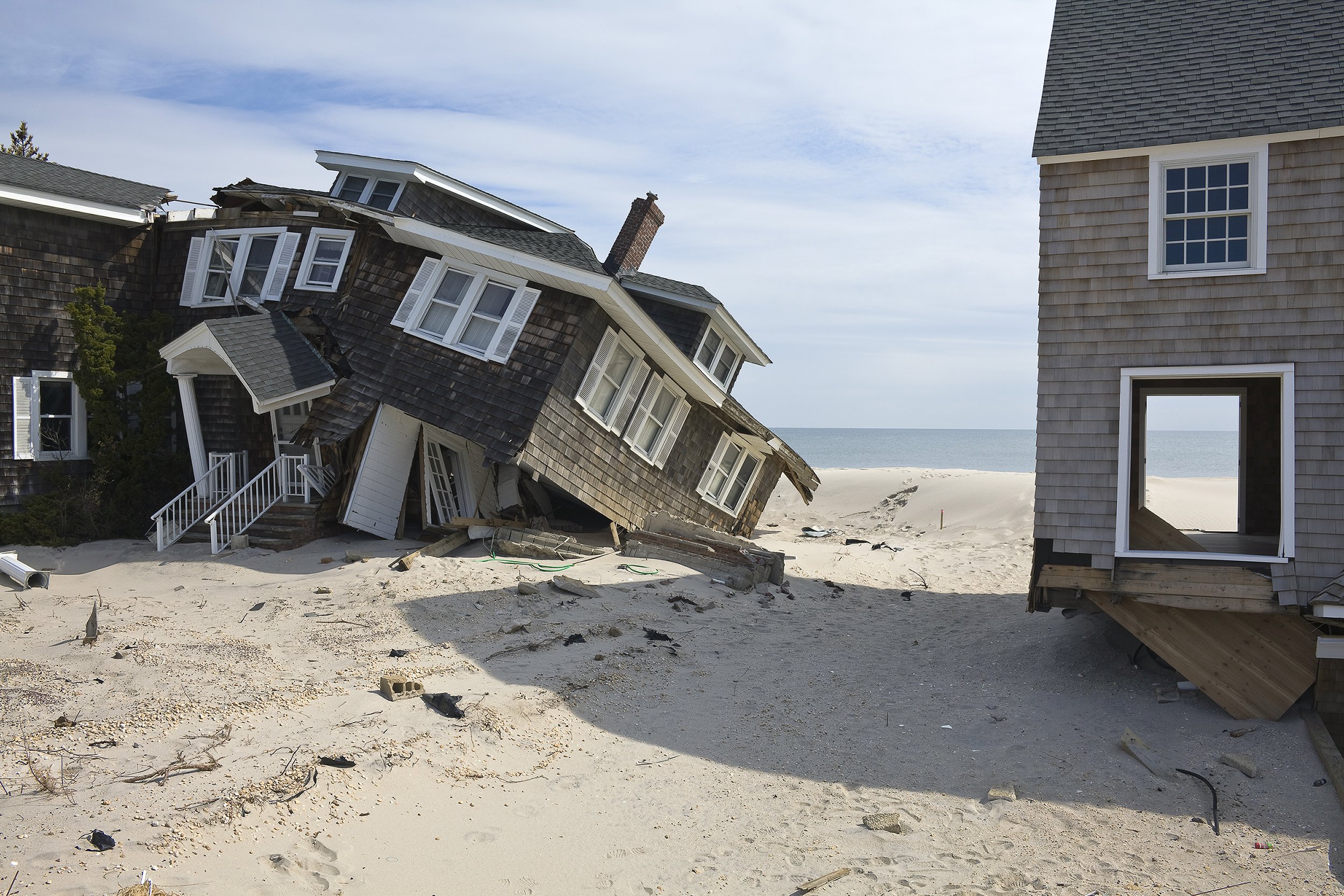
Ocean Boulevard Houses, Breach Inlet, Isle of Palms, South Carolina, 2014. Elevation Six Feet. N 32.77632 W 79.81101

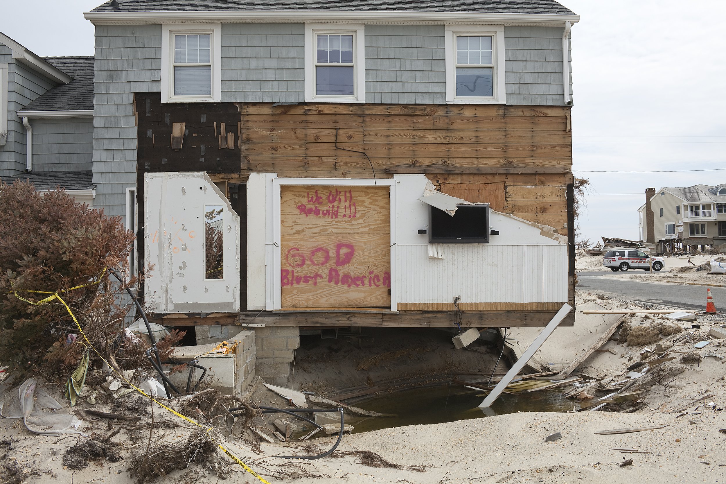
Water-damaged Home, with Insulation Removed after Hurricane Irene, Mesic, North Carolina, 2011. Elevation Two Feet. N 35.20081 W 76.63474
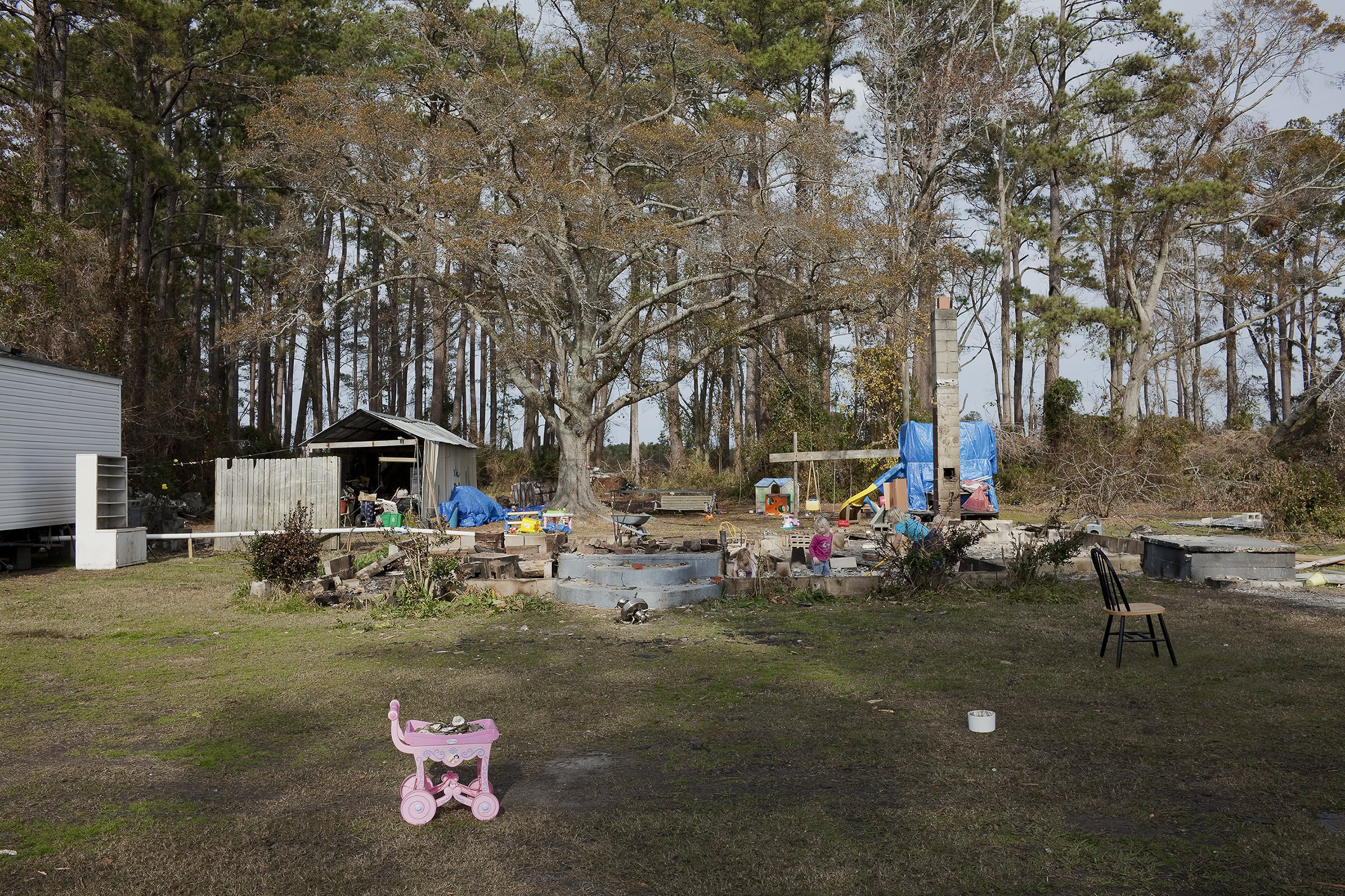
Remains of a House Destroyed by Hurricane Irene and Burned by Its Owners, Lowland, North Carolina, 2011. Elevation Eight Feet. N 35.58038 W 75.46683
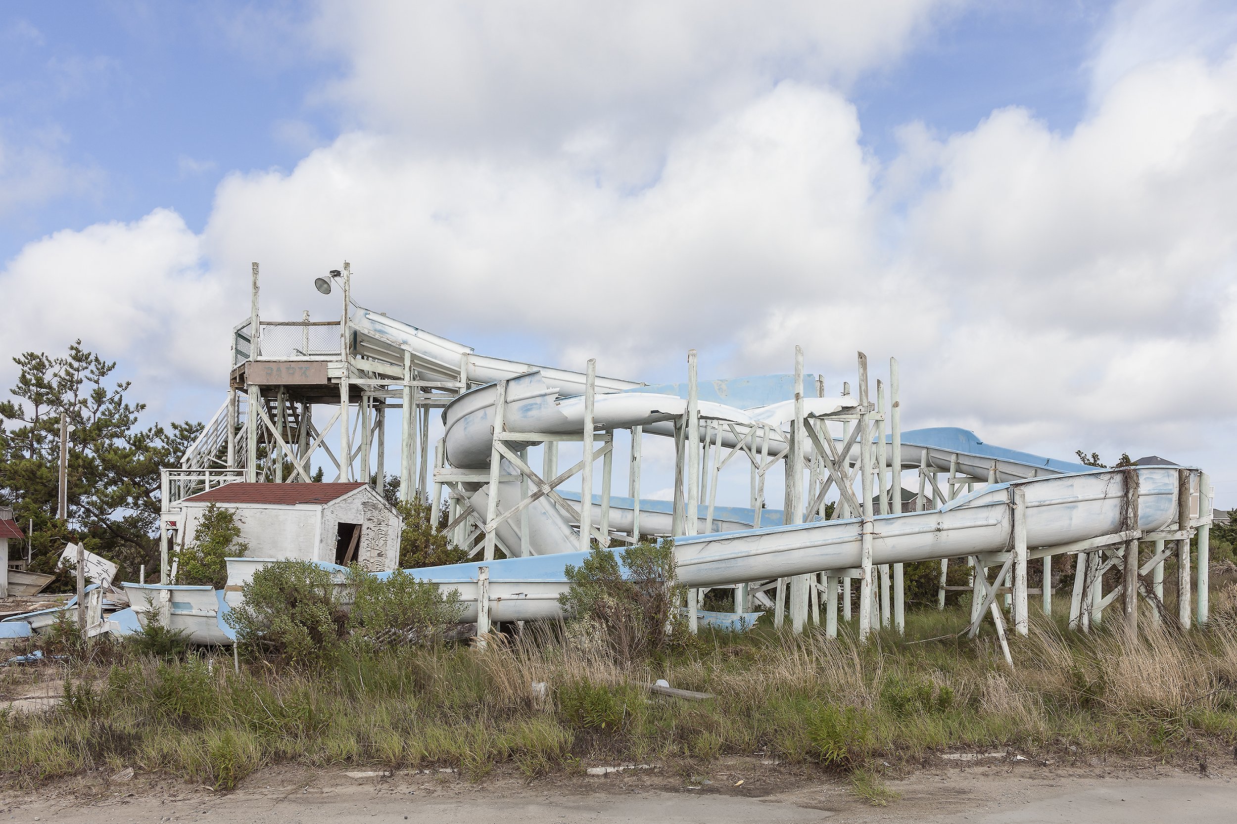
Water Slide Destroyed by Hurricanes Irene and Arthur, Outer Banks, Rodanthe, North Carolina, 2014. Elevation Eight Feet. N 35.58038 W 75.46683
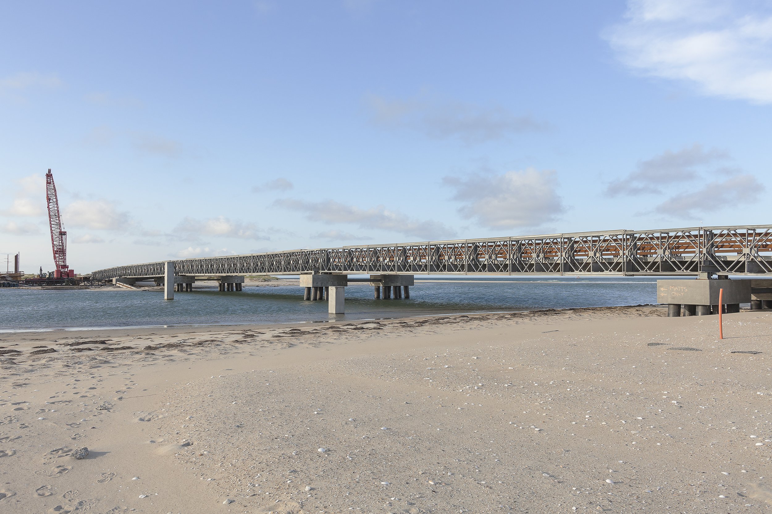
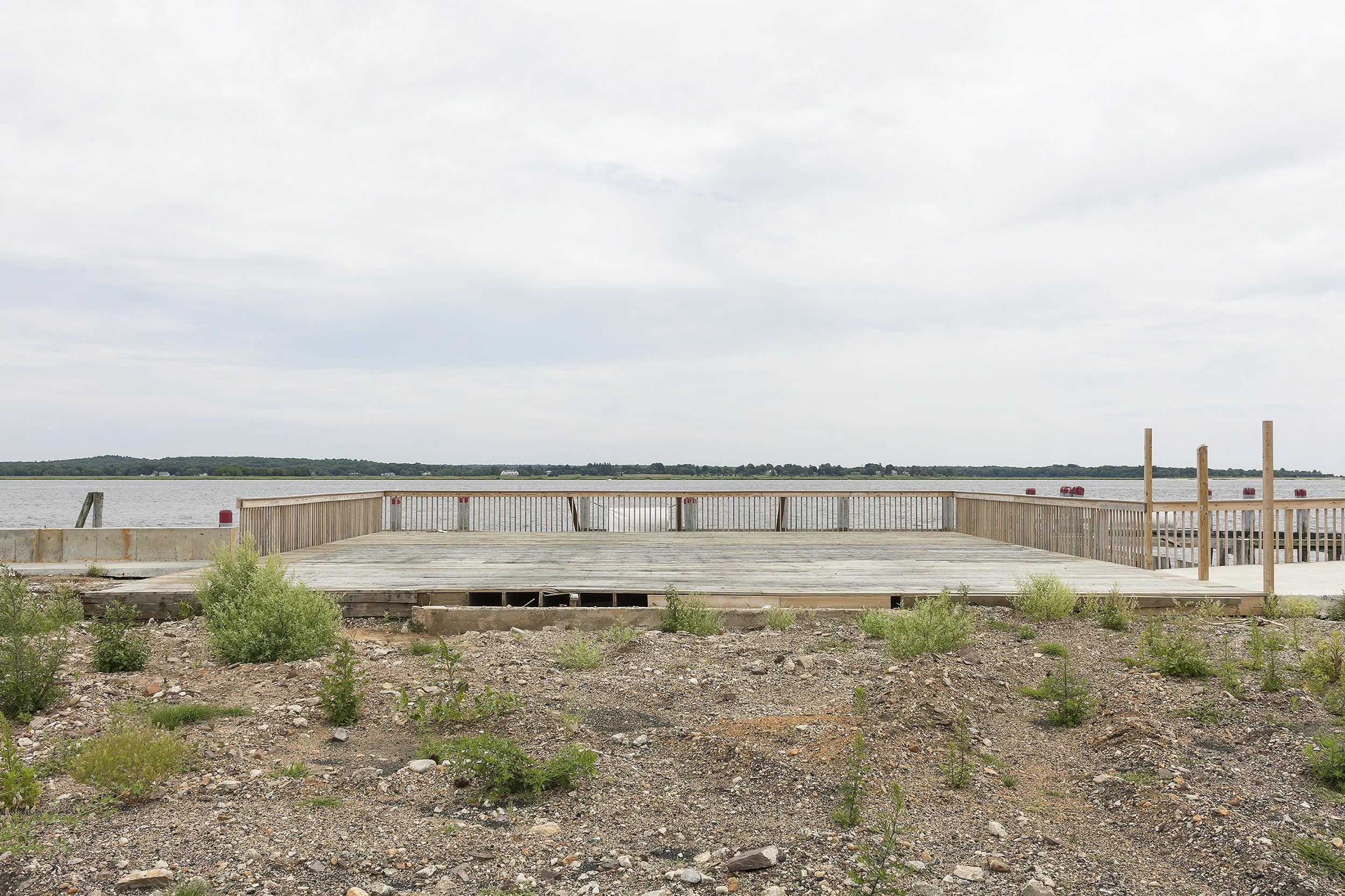
Bridge Constructed over New Inlet, a Breach Caused by Hurricane Irene, NC 12, Outer Banks, North Carolina, 2014. Elevation Four Feet. N 35.68362 W 75.48393

Pirates Cove Development, Roanoke Island, Manteo, North Carolina, 2014. Elevation Three Feet. N 35.89523 W 75.63827
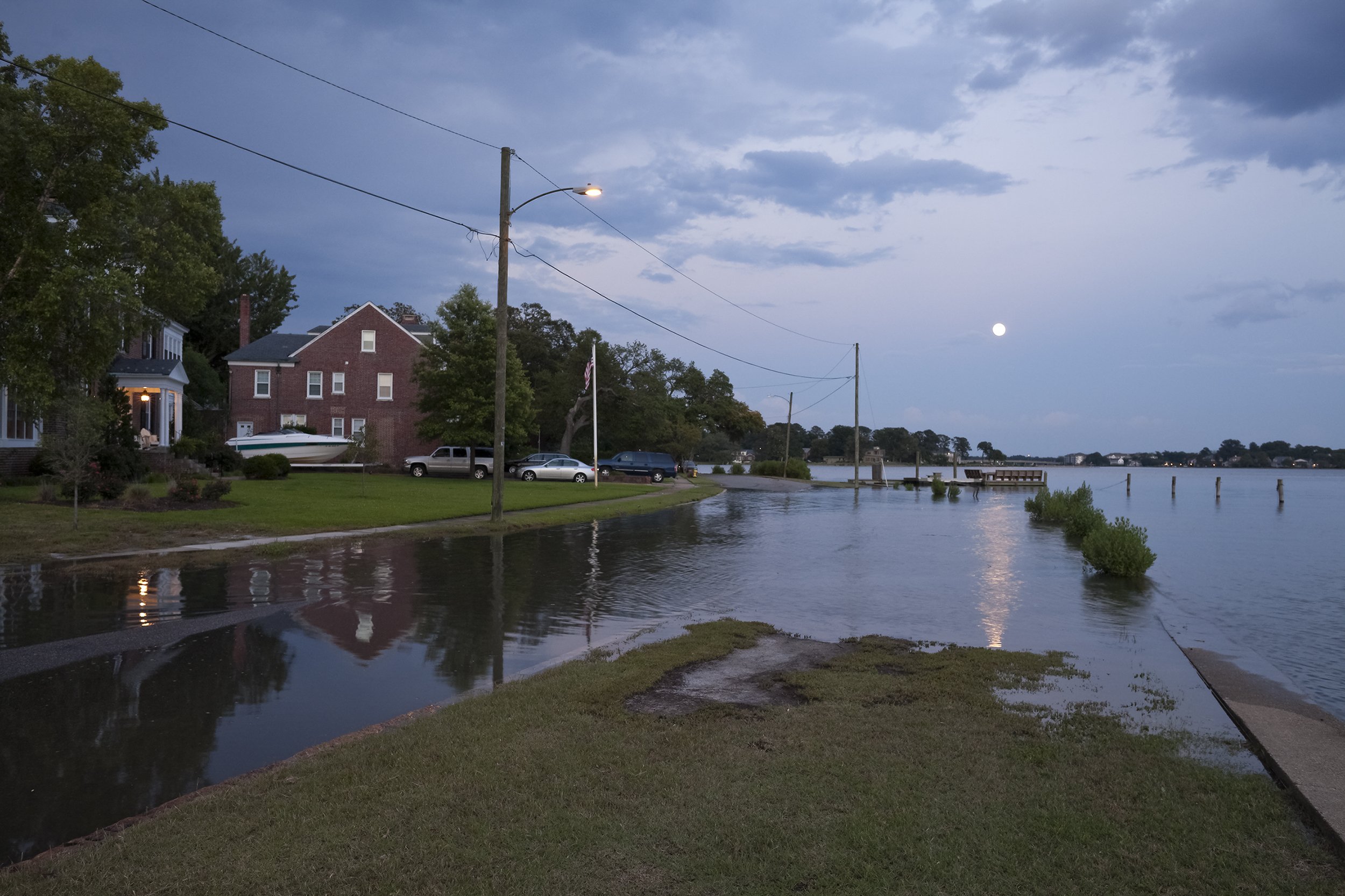
Flooding at High Tide and a Full Moon, Cambridge Place, Norfolk, Virginia, 2012. Elevation Two Feet. N 36.89701 W 76.28584
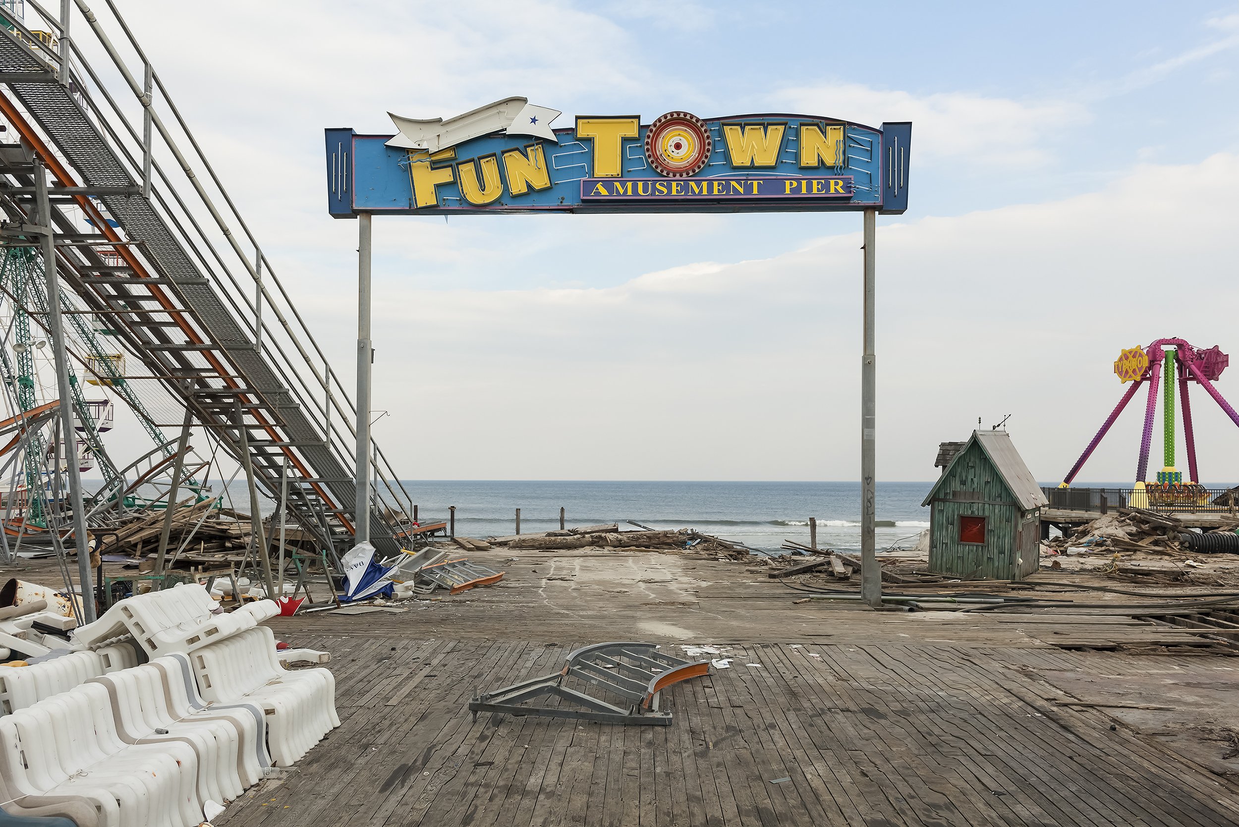
Pier Entrance, Fun Town Amusements, Destroyed by Hurricane Sandy, Seaside Park, New Jersey, 2013. Elevation Sixteen Feet. N 39.94122 W 74.07093
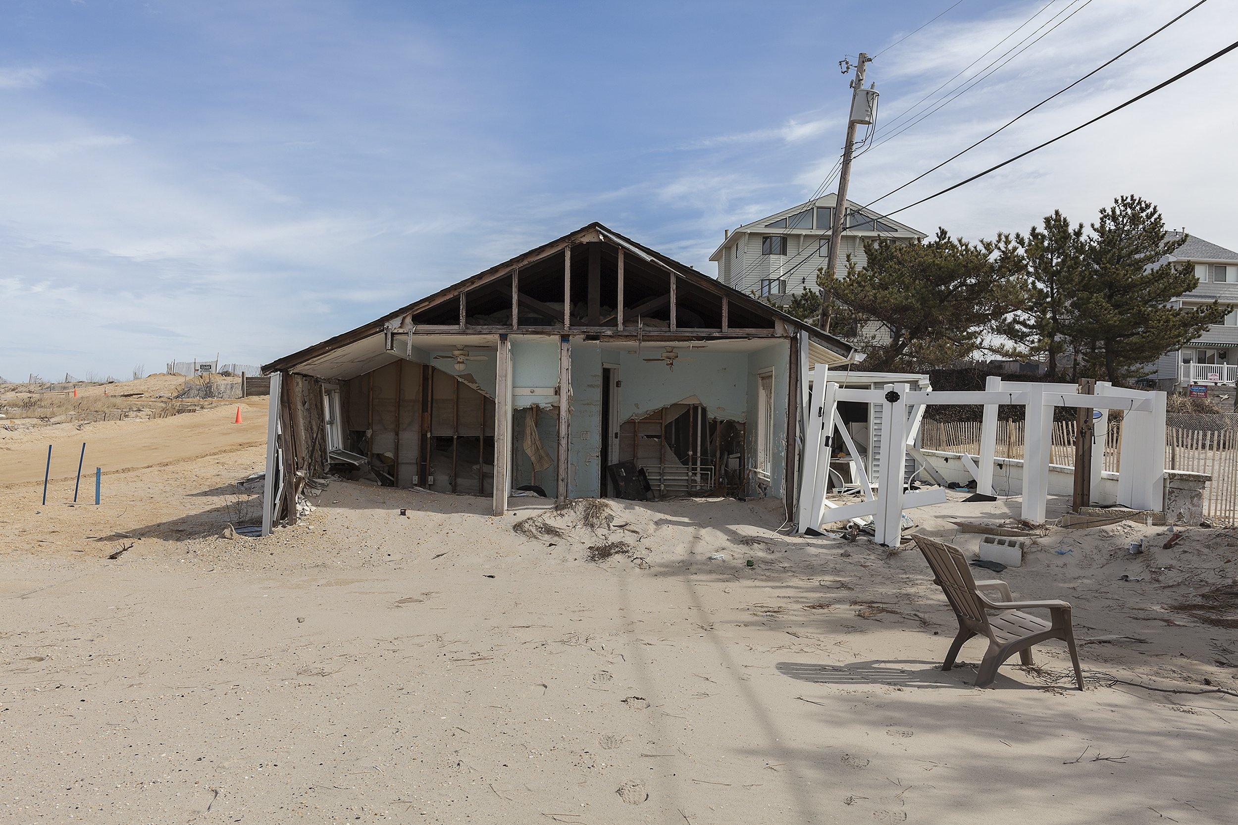
21 South Beach Drive, Vision Beach, Seaside Heights, New Jersey, 2014. Elevation Seven Feet. N 39.95051 W 74.07018
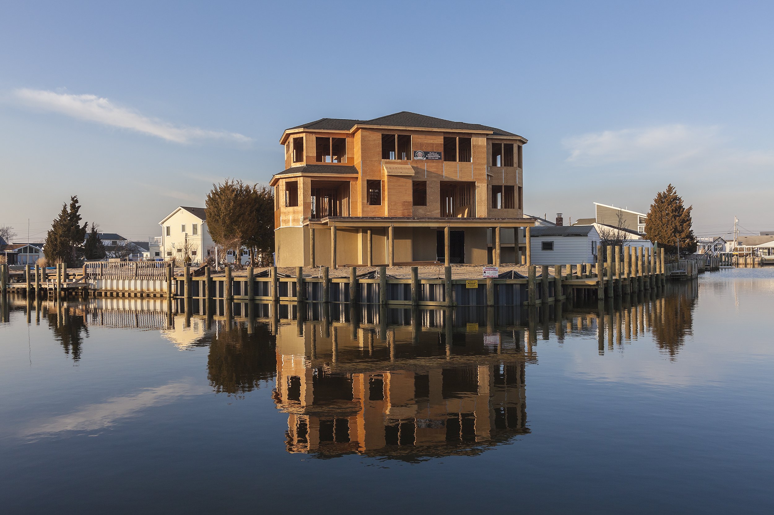
New Construction after Hurricane Sandy, 28 Jack Lane, Beach Haven West, New Jersey, 2014. Elevation Six Feet. N 39.66617 W 74.23008

Swimming Pool at the Site of a Removed House, 1001 Ocean Avenue, Mantoloking, New Jersey, 2014. Elevation Three Feet. N 40.05077 W 74.04826
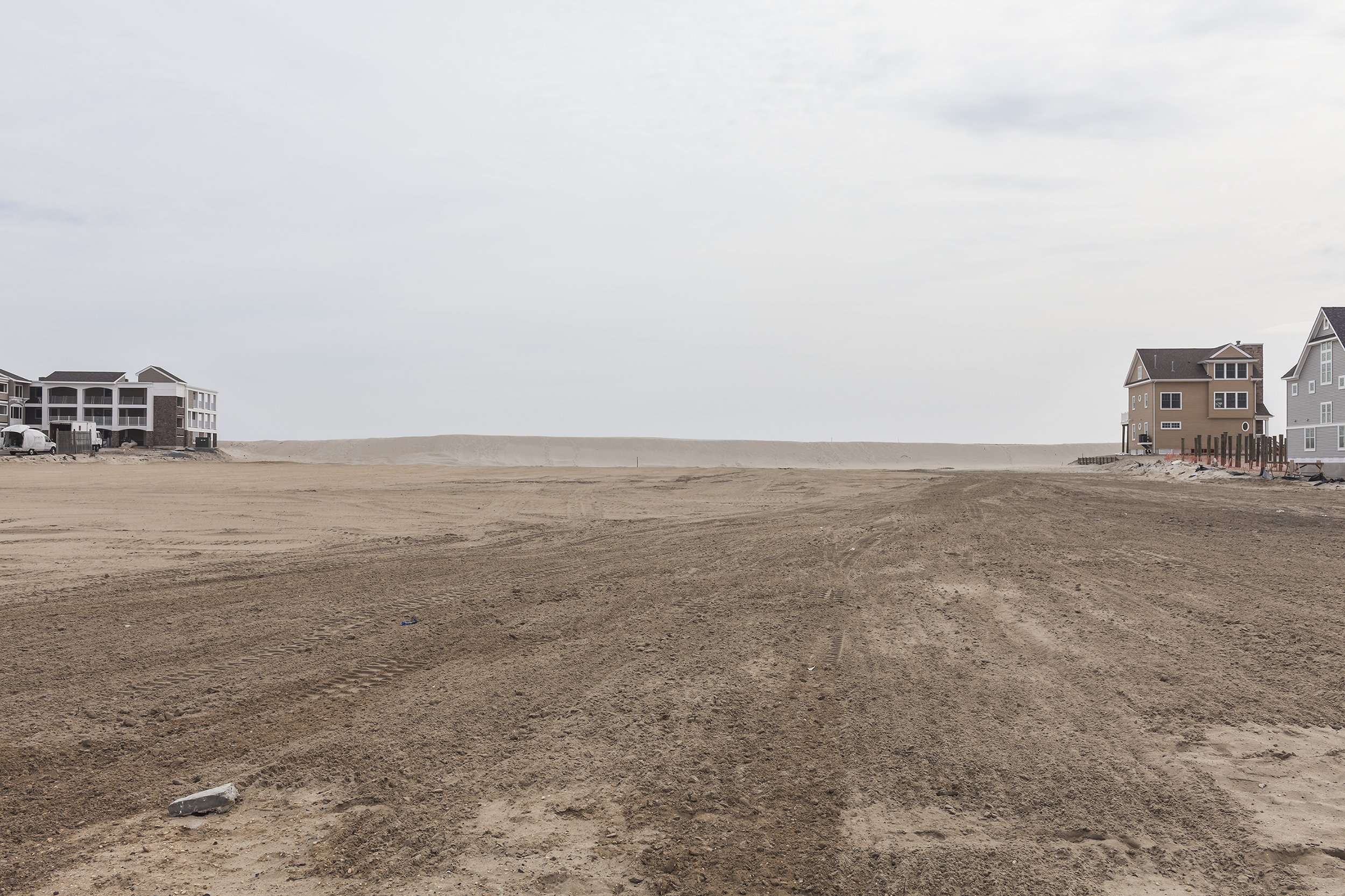
Site of Camp Osborne Beach Community (about 100 Cottages in Total Destroyed by Hurricane Sandy), Mantoloking, New Jersey, 2014. Elevation Four Feet. N 40.00771 W 74.05885
Beach Houses after Hurricane Sandy, 959 East Avenue, Mantoloking, New Jersey, March 2013. Elevation Nine Feet. N 40.05418 W 74.04623
Ocean Avenue at Stephens Place after Hurricane Sandy, Mantoloking, New Jersey, 2013. Elevation Three Feet. N 40.05249 W 74.04761
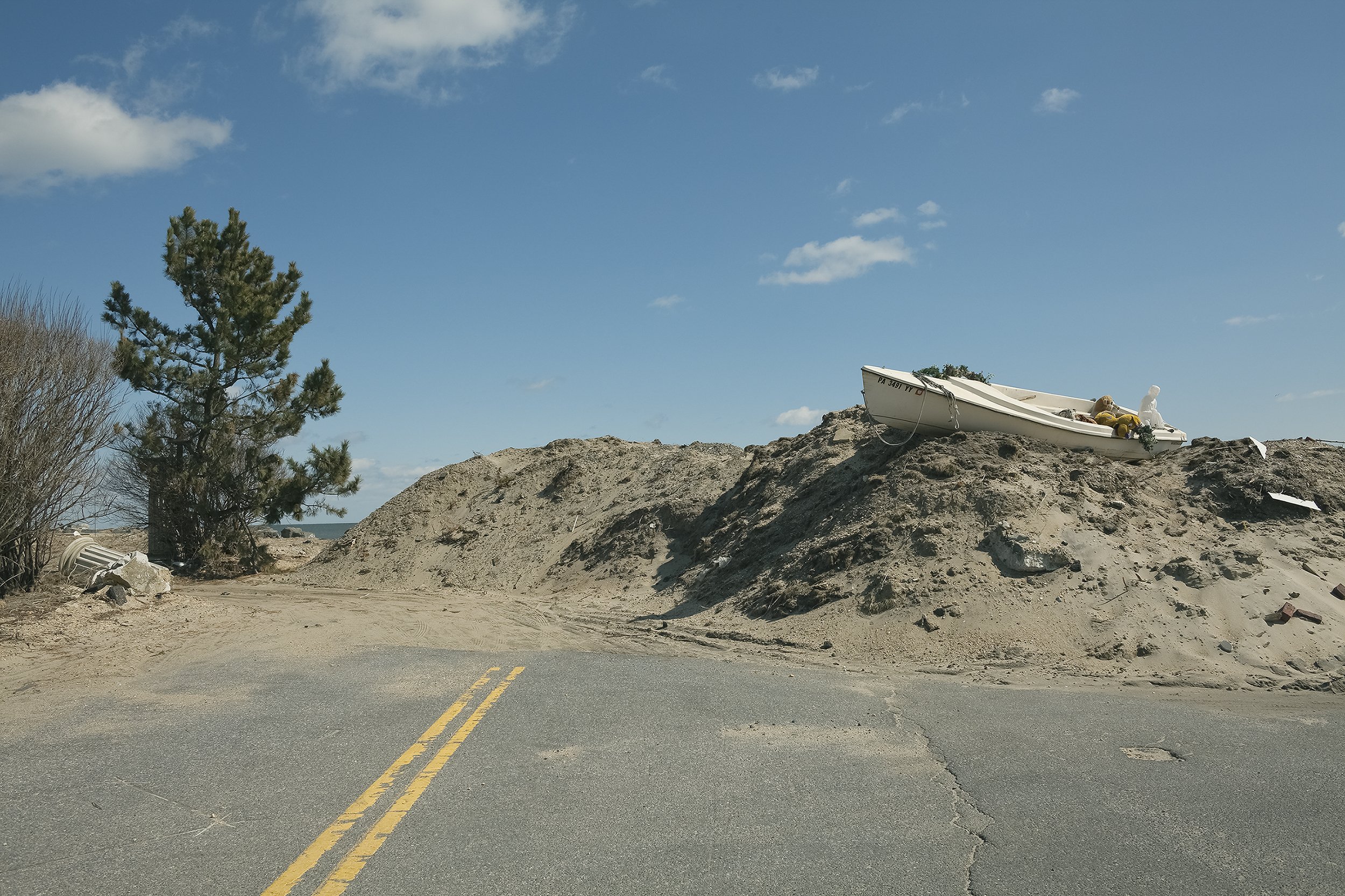
Boat with Christmas Decorations on an Engineered Sand Dune after Hurricane Sandy, Monmouth Beach, New Jersey, 2013. Elevation Ten Feet. N 40.32709 W 73.97551
35 Ocean Avenue at Valentine Street after Sandy under Repair and for Sale, Monmouth Beach, New Jersey, March 2013 and March 2014. Elevation Twelve Feet. N 40.32719 W 73.97525

New Seawall and Damaged House, 136 B144 Street, Rockaways, New York, 2014. Elevation Nine Feet. N 40.56934 W 73.85868
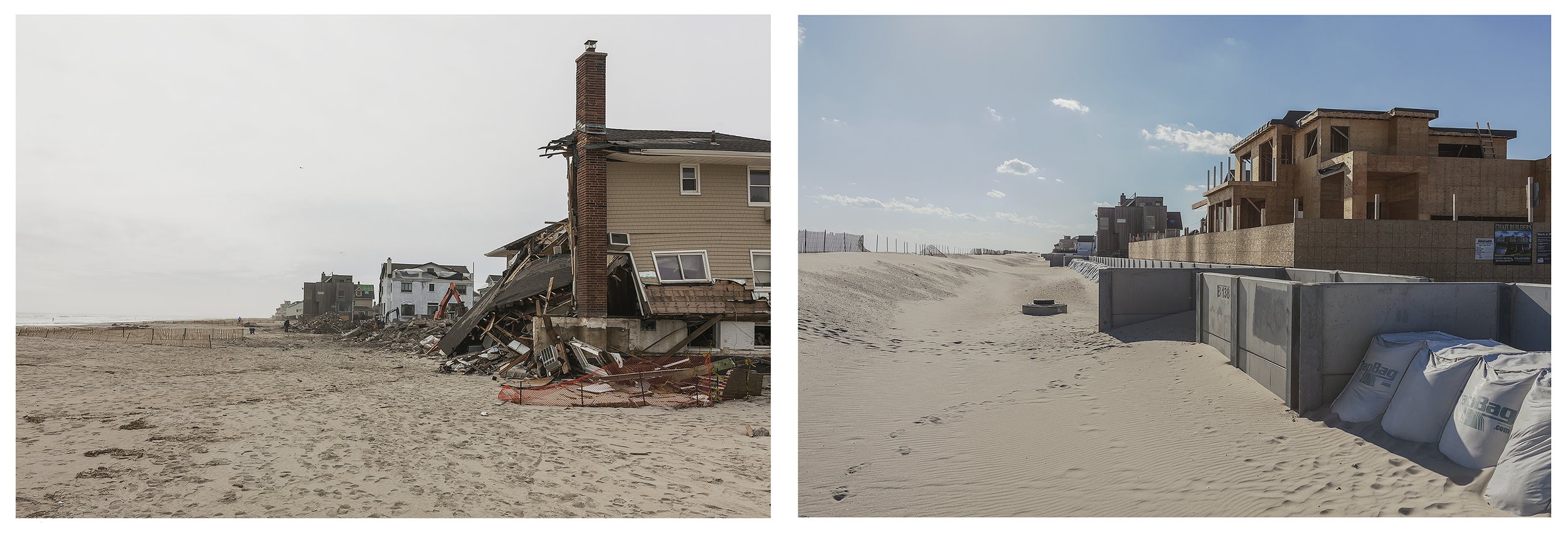
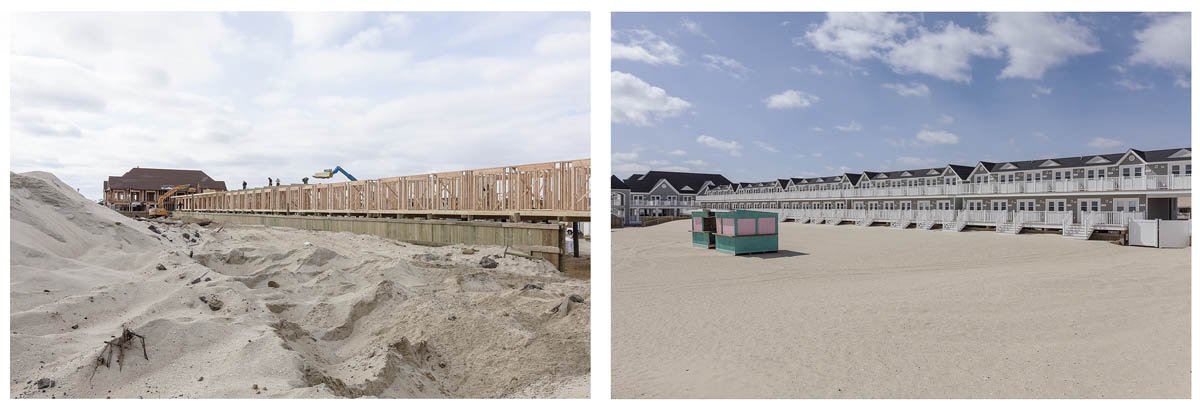
After Hurricane Sandy, Rebuilding Bigger behind a New Sea Wall, B138 Street, Rockaways, New York, March 2013 and March 2014. Elevation Eight Feet. N 40.57104 W 73.85412

Site of a Father and Child Fatality from Hurricane Sandy, 687 Yetman Avenue, Staten Island, March 2013 and March 2014. Site included in the New York Buy-Out Program, Redevelopment Prohibited Elevation Two Feet. N 40.49904 W 74.23944


Bath Iron Works, a Strategically Important Shipyard for the U.S. Navy, Bath, Maine, 2015. Elevation Two Feet. N 43.91079 W 69.81285
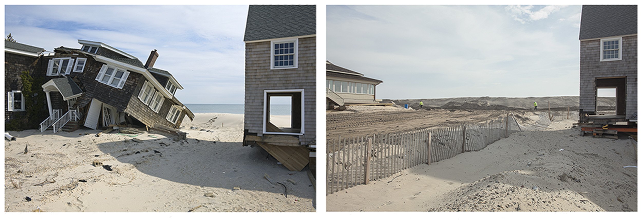
After Hurricane Sandy, Beach Houses Remaining, Site later Cleared and a Protective Dune Installed, 959 East Avenue, Mantoloking, New Jersey, March 2013 and March 2014. Elevation Nine Feet. N 40.05418 W 74.04623
The Endangered Coast
The Future Is Now
Climate change has been scientifically proven and is here and now. It portends a bleak future for humankind and is a global crisis of great urgency that, thankfully and at last, was acknowledged by the international community at the Paris accord on climate of December 2015. This book is my response to this phenomenon.
For this project, my photographic approach was to document sites along the Gulf and Atlantic Coasts so low in elevation that they will be severely affected by rising sea levels and storm surges. I have photographed these coastal areas as they are today, in their seemly normal “business as usual” state. I also photographed sites affected by big coastal storms such as the Hurricane of 1933 and Hurricanes Rita and Katrina in 2005, Gustav and Ike in 2008, Irene in 2011, Sandy in 2012, and Arthur in 2014. Being so close to the water, these sites of storm damage are at an elevation that makes them vulnerable to high tides, storm surges, and hurricanes. These storms are now more frequent and severe because of global warming in the oceans and atmosphere. In 2014, I revisited sites I had previously photographed in 2010 and 2013 to show the changes during the slow recovery from these brutal storms. For all photographs in the book, I record the exact locations with GPS coordinates and elevations above sea level to emphasize the specificity and fragility of these environments. In the future, these sites may be revisited by anyone tosee the ongoing changes that are sure to come as sea levels rise.
The current effects of high tides, storm surges, and hurricanes on low-lying coastal areas (essentially any elevation less than fifteen feet) give us a glimpse into the future in which these same areas will be frequently under attack or completely destroyed as seas continue to rise and storms intensify. The most recent IPCC (Inter-governmental Panel on Climate Change) estimates for sea levels a century from now predict a rise of 3.3 feet (1.006 meters) as a virtual certainty, with a plausible range much higher, according to recent scientific research by Dr. James Hansen and others. A five-foot (1.524-meter) rise would submerge 22,000 square miles (56,980 square kilometers) of U.S. Coastline on the Atlantic and Gulf Coasts alone. All the other coastal areas of the world will, of course, share this fate, since the vast majority of people live in coastal regions. After the 100-year mark, seas will continue to rise, as the effects of global warming will continue and even spiral completely out of control, if action from the Paris accord fails to meet the minimum prescribed goals for an increase in the world’s atmospheric temperature. To that end, there may still be time to stabilize the global climate, if and only if the current “business as usual” patterns of human activity are changed in the near future.
My photographs show the unsustainable and seemingly endless development of barrier islands and other fragile and low-lying coastal environments. They underscore the absurdity of our current state of denial, when it comes to climate change and sea-rise.