Oil Spills: Ruptures and Reclamations

Oiled Booms, Barataria Bay near Queen Bess Island, Grand Isle, Louisiana 2010

Lagoon damaged by BP oil spill Grand Isle State Park, Grand Isle Louisiana 2010

Oil Spill Containment Caminada Pass, Port Fourchon, Louisiana 2010

Oil floating on water, near Grand Terre Island, Barataria Bay, Louisiana 2010

Closed Sea Food Stand, Golden Meadow, Louisiana, 2010

BP Oil and fishing net washed up on shoreline, National Sea Shore Park, Santa Rosa Island, Florida, 2010

Oil on Apple, Pensacola Beach, Florida 2010

Oil on Plastic Bottle, Pensacola Beach, Florida 2010

Clean-up Workers, National Sea Shore Park, Santa Rosa Island, Florida 2010
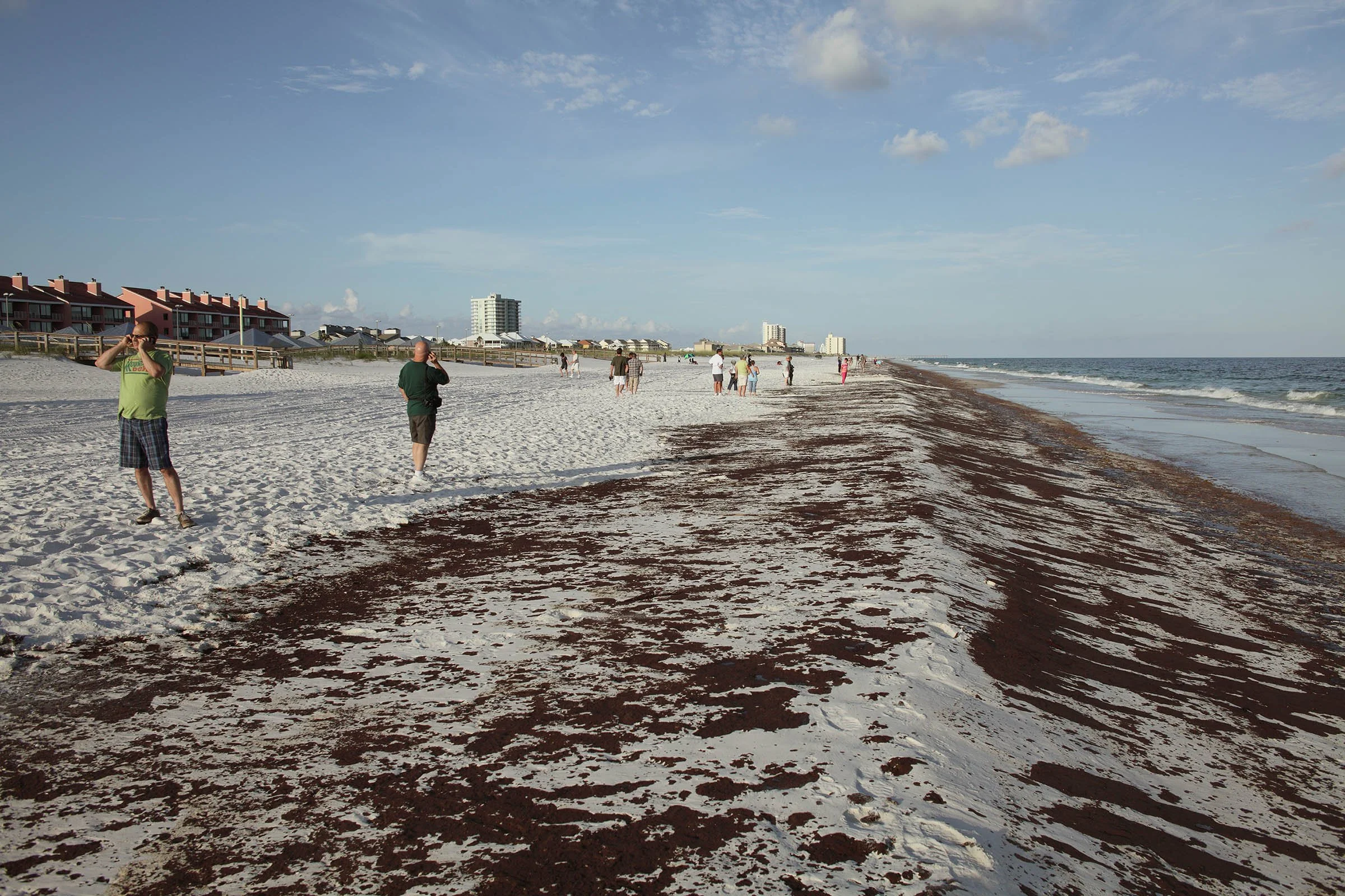
Oil Spill Bystanders on cell phones, Pensacola Beach, Florida, 2010

Oil Spill Witness, Pensacola Beach, Florida, 2010

Troops erecting protective oil spill barriers, Fort Morgan, Alabama 2010

Clean-up Workers, Gulf Shores, Alabama, 2010

Resident Watching front end loader, BP clean-up, Pensacola Beach, Florida, 2010

Bags of Contaminated Sand and clean-up tools, Gulf Shores, Alabama, 2010

Tar Sands Oil in the Kalamazoo River, Battle Creek, Michigan 2010

Oil Spill in Kalamazoo River, South Wattles Road Bridge, Battle Creek, Michigan 2010

Enbridge Clean-up Workers, Kalamazoo River at the Ceresco Dam, Ceresco, Michigan, 2010
Ruptures and Reclamations
BP’s Deepwater Horizon offshore well exploded on April 20, 2010 spilling oil in the Gulf of Mexico at a rate of 2.2 million gallons of oil a day. The well was capped in late July. The devastating effects of this disaster will be felt for decades to come. It is recognized as the worst environmental disaster in American history.
In June of 2010 I photographed the effects of the spill in Grand Isle, Louisiana, Gulf Shores, Alabama, and Pensacola, Florida. The resulting images, shown here were taken between June 19th and June 26th. When I arrived I Grand Isle, Louisiana a vast amount of oil was floating mile off shore closer to the site of the blown out well. This oil was temporarily being kept offshore by the prevailing winds. The initial major wash-up of oil had already been largely cleaned up but there were a large number of BP and Coast Guard and other clean-up personnel on the beaches that were closed to all unauthorized individuals. The beach had an eerie quality of emptiness (on such beautiful summer days) and a wall of huge orange booms stretched for miles on the beach. From Grand Isle I traveled to Gulf Shores Alabama, a heavily developed tourist destination near the Pensacloa Florida and I went back and forth between the two locations. There were very large wash-ups of oil particularly on Pensacola Beach and the adjacent National Sea Shore from June 22nd to 25th. Although the whole situation was horrifying in its environmental impact, I was continually impressed by the dedication and professionalism of all the clean-up workers, who worked in shifts literally 24 hours a day to clean the sand with hand tools in most cases.
On July 25, 2010 the Enbridge pipeline carrying heavy oil sands crude between Gary Indiana and Sarnia, Ontario ruptured. It took the company over 12 hours to identify and report the leak and it resulted in about a million gallons of oil going into Talmage Creek and the Kalamazoo River near Marshall. The spill was also particularly bad in Emmett Township, a part of greater Battle Creek. This was the area that I photographed on two occasions, August 4th and October 3th. The Enbridge oil spill is regarded as the largest environmental disaster in the Midwest region and the largest oil spill in the inland US. There have been numerous reports of illness and assessments indicate a extensive amount of environmental damage and associated remediation efforts stretching years into the future. Because the oil in the pipeline was the thick bitumen from the Alberta Tar Sands it has been extremely difficult to clean up and the EPA has mandated that the oil removal, now in its third year, continue through the end of 2013.
My photographs are a personal response to documenting the situations described above. As always my photographs are intended to work on multiple levels so that the images are not made with a didactic approach but rather I am constantly seek the metaphors that will extend the viewer’s understanding from the specific situation photographed to a wider perspective. The photographs, some of which are made with specialized panoramic camera equipment emphasize both the micro and the macro on a large scale. I hope that the audience will find these images revealing and that they will stimulate a conversation about the incalculable consequences of corporate greed and negligence.